Australian Bushfire Facts or Fiction.
Social Media of various types are showing some alarming “facts” about the Australian Bushfires.
These can include statements that ALL of Australia is burning, or that all the fires are started by arsonists.
Many of these things are simply NOT true.
- There are approximately 9 million houses in Australia. About 2,500 have been damaged in the 2019-20 bushfires.
That is 1 house in every 3,600 houses in the country that has been damaged. - Australia covers 770 million hectares in total. About 20 million hectares has been burnt this fire season. This mean that 750 million hectares has NOT been burnt (97% of the country has NOT been burnt). In the 1974-75 fire season it was 117 million that was burnt out, (ie: 15% of the country in the 1974-75 fires).
- Some say that Arson is the cause of all the fires, and say the Police reports of 200 people being charged prove that.
But, only 24 were charged with arson, the rest were cautioned or charged with accidentally starting a fire. (..legal-action-against-183-fire-starters-in-nsw/). The Australian Productivity Commission states that the number of bushfires in Australia is about an average of nearly 54,000 fires per year. So, about 24 started deliberately out of 54,000. - A billion animals have died in the fires. This is semi true, in that they have died, or they are expected to die due to loss of habitat and food, after the fires. A large number of these animals are Rats, Mice, Snake and Lizards. The numbers are an estimate based on 2007 calculations. (Half a Billion Animals Died in Australia)
Photographs showing Australian Burning.
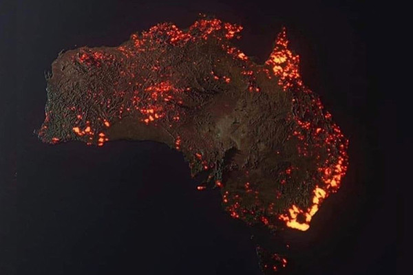
We have seen photoshopped images and maps, that appear to show Australia totally on fire.
This one, stating to be a satellite photo of Australia, is being heavily publicised, but is widely inaccurate. It is in reality, an artist’s visualisation of what it could be.
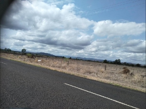
I live in one of those areas that is bright red, supposedly in flames, but this is what my area looks like today:
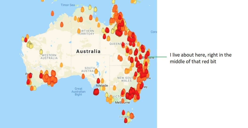
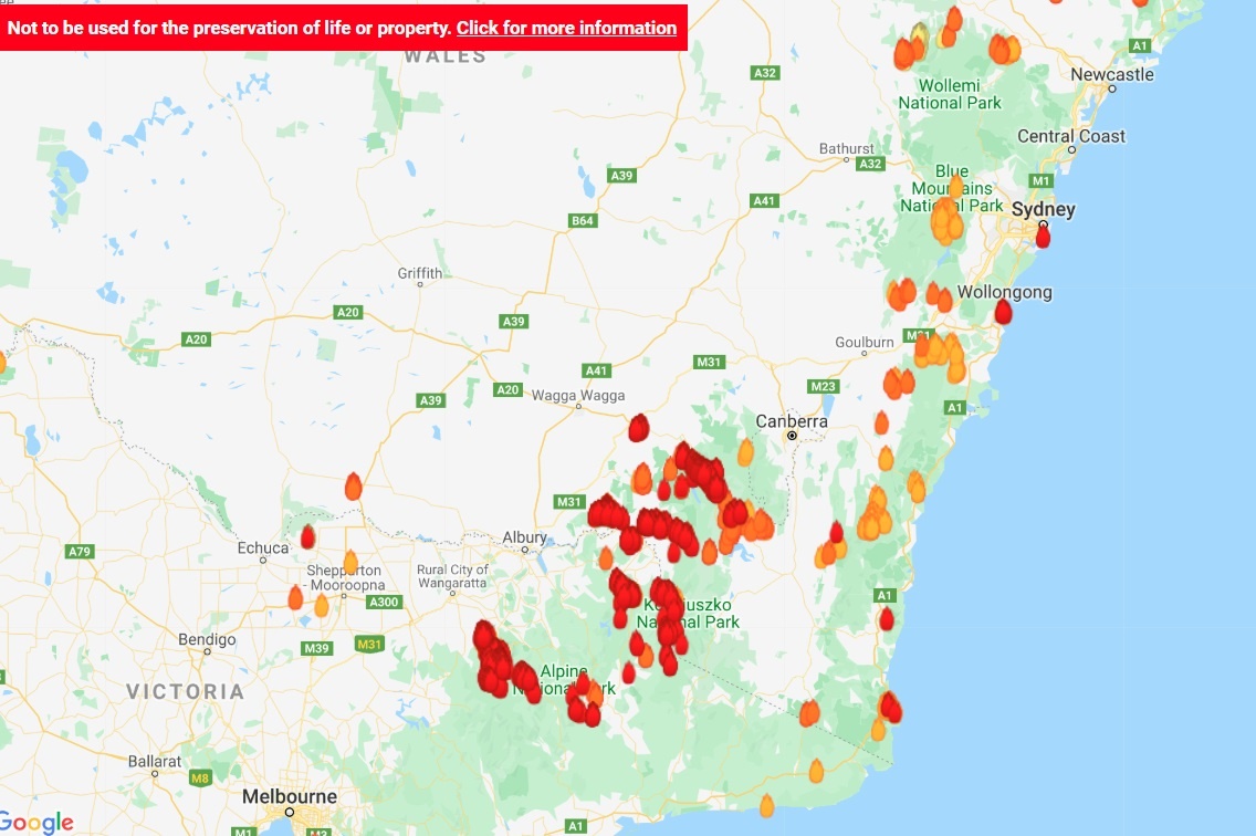
Another map that shows fire locations, is this one at myfirewatch.landgate.wa.gov.au/:
But when you zoom in, you see it a LOT clearer, and nothing like what you might have thought.
You can now see how widespread the fires are, compared to the first image. All the red fire signs are current fires.
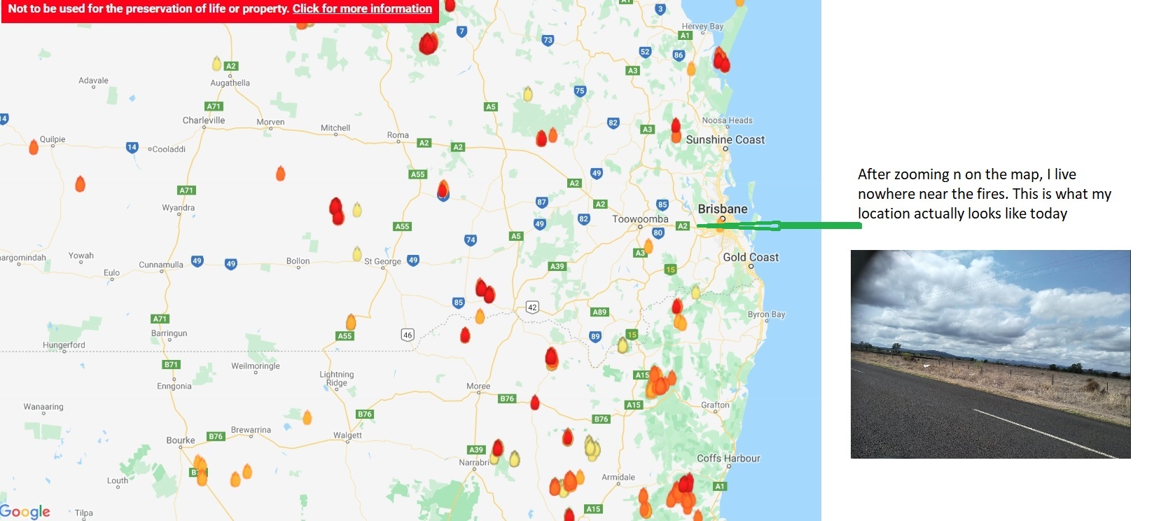
Sydney is worse than Brisbane, but again, when you zoom in, you can see the real story of the fires.. The Kosciuszko National Park is clearly still burning, but much of NSW is not. There is a lot of smoke though, although the maps do not show that…
Do NOT believe everything you read or see on Social media.